


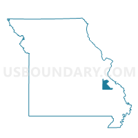
Knob Lick Voting District, St. Francois County, Missouri
About
Outline

Summary
| Unique Area Identifier | 609734 |
| Name | Knob Lick Voting District |
| County | St. Francois County |
| State | Missouri |
| Area (square miles) | 37.50 |
| Land Area (square miles) | 37.16 |
| Water Area (square miles) | 0.35 |
| % of Land Area | 99.08 |
| % of Water Area | 0.92 |
| Latitude of the Internal Point | 37.67504170 |
| Longtitude of the Internal Point | -90.35834530 |
Maps


Graphs
Select a template below for downloading or customizing gragh for Knob Lick Voting District, St. Francois County, Missouri


Neighbors
Neighoring Voting District (by Name) Neighboring Voting District on the Map
- Busiek Voting District, St. Francois County, MO
- Doe Run Voting District, St. Francois County, MO
- Libertyville Voting District, St. Francois County, MO
- St. Francis Voting District, Madison County, MO
Top 10 Neighboring County Subdivision (by Population) Neighboring County Subdivision on the Map
- St. Francois township, St. Francois County, MO (29,371)
- Pendleton township, St. Francois County, MO (3,372)
- Liberty township, St. Francois County, MO (2,232)
- Polk township, Madison County, MO (920)
- Mine La Motte township, Madison County, MO (843)
Top 10 Neighboring Unified School District (by Population) Neighboring Unified School District on the Map
- Farmington R-7 School District, MO (27,796)
- Fredericktown R-I School District, MO (10,918)
- Arcadia Valley R-II School District, MO (5,908)